There is a new Edition of the Elgin – St Thomas Cycling & Hiking Trail Map. Download or view from the link, our trail is marked in orange.
Fingal Wildlife Management Area
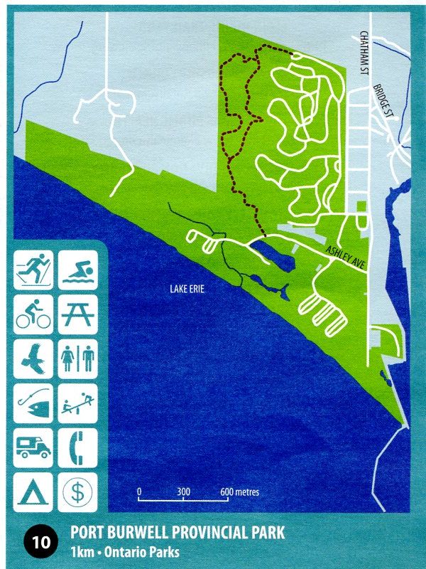
Port Burwell Provincial Park
Springwater Conservation Area
Yarmouth Natural Heritage Area
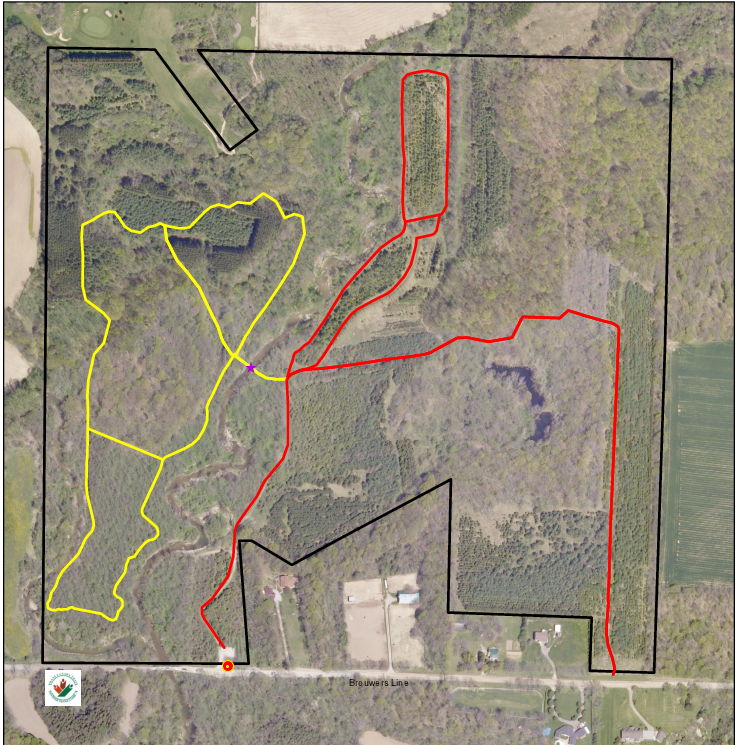
Archie Coulter Conservation Area
46900 Brouwer’s Line – south of hwy 3 at Orwell
4.2 kilometres of trail
Dalewood Conservation Area

Referenced from Hwy. 401: Take exit 189, Highbury Ave. South for approx. 14 km and turn right on Ron McNeil Line at the traffic lights, continue approx. 2.5 km and just past a big dip in the road turn left on Dalewood Drive, follow this till you arrive at a single lane bridge, cross and immediately turn left into a small parking area.
Dan Patterson Conservation Area
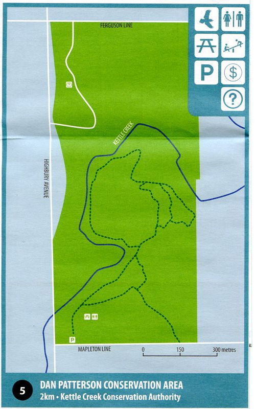
Referenced from Hwy. 401: Take exit 189, Highbury Ave. South for approx. 13 km. Just past Ferguson Line the highway crosses a cement bridge and immediately after you turn left on Mapleton Line. The Dan Patterson Area is on your left with a small parking lot.
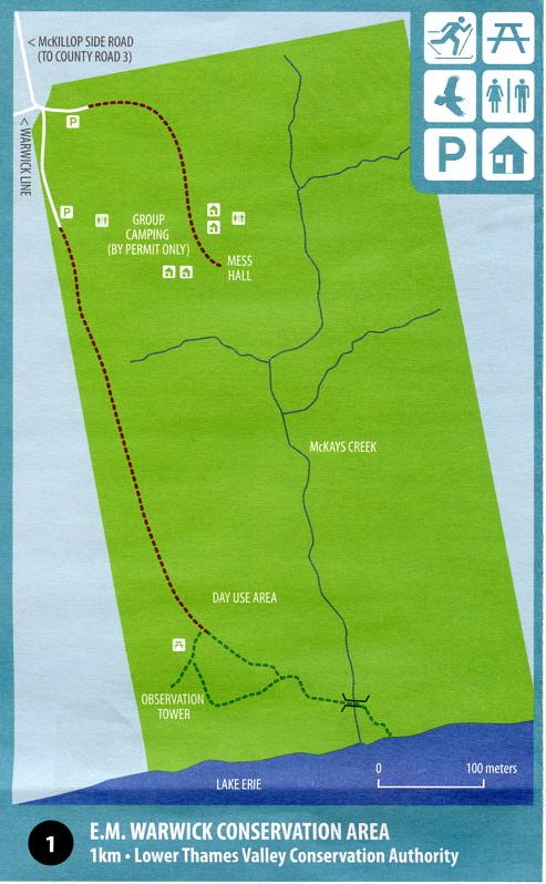
E. M. Warwick Conservation Area
26135 Warwick Line, follow Talbot Trail (Hwy 3) east from Eagle, take McKillop Side Road south for 3 km.
Fingal Wildlife Management Area
34469 Fingal Line
Hunting small game is permitted on Mondays, Wednesdays, Thursdays and Saturdays during appropriate seasons and in accordance with Provincial Hunting Regulations.

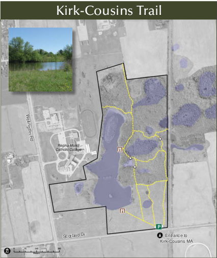
Kirk-Cousins Management Area
Scotland Drive
(Day use permit required)
Lake Margaret Trail

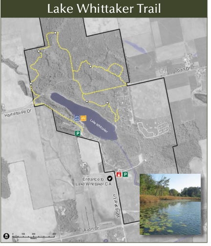
Lake Whittaker Conservation Area
5840 Whittaker Lane, Harrietsville
Port Burwell Provincial Park
9 Wilson Lane
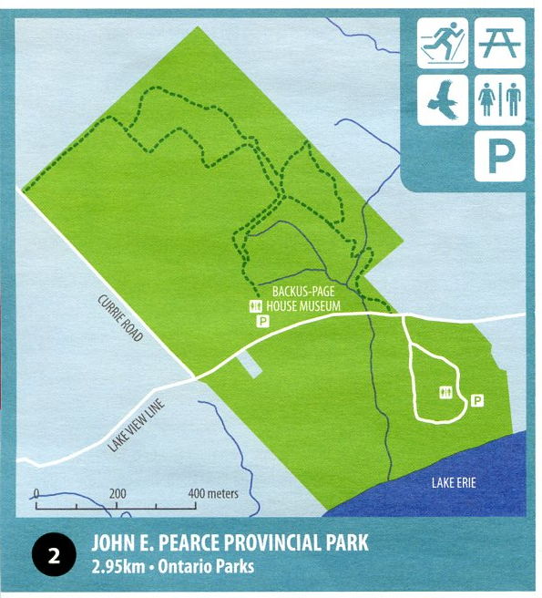
John E Pearce Provincial Park
Spicer Trail
29424 Lakeview Line
Springwater Conservation Area
Forest Trails
8079 Springwater Road
The Springwater Conservation Area provides 8 kms of hiking trails open year-round. A nominal donation of $3.00 per person is requested to help support maintenance of the trails. Fee boxes are located at each entrance of the trails.

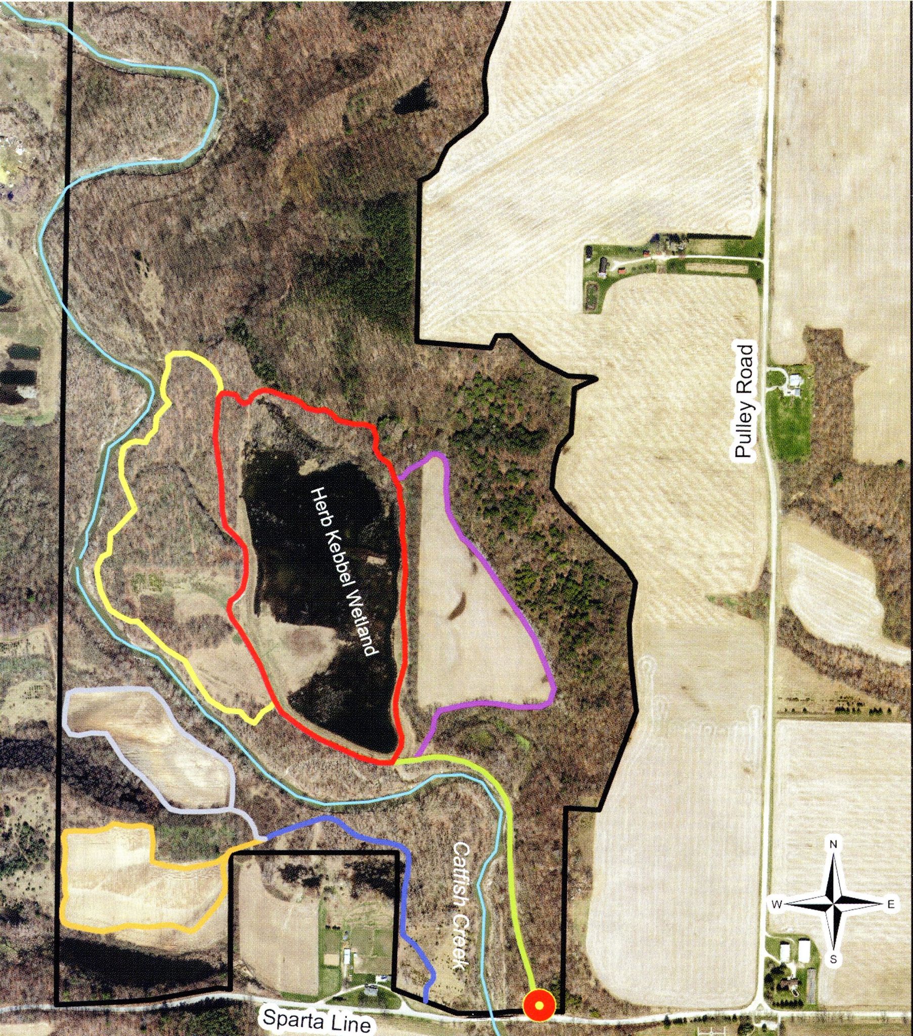
Yarmouth Natural Heritage Area
47502 Sparta Line
5.6 kilometers of trail